Tenerife is in Spain’s idyllic Canary Islands. It is a place full of natural paradises but many of them can only be reached on foot. Some of the most beautiful Tenerife hiking trails are in the north of the island and allow you to get to know a wide variety of landscapes.
A good example is the Anaga Rural Park. It is one of the most popular destinations for hiking enthusiasts who want to discover each of its corners.
THREE BEAUTIFUL TENERIFE HIKING TRAILS
TAGANANA TO TAMADITE BEACH
A circular route that covers a total distance of 14 km and takes about 6 hours. It starts in the hamlet of Afur.
DREAMING OF THE MALDIVES
In the beginning, it runs through a beautiful ravine until it reaches the beach of Tamadite. It then runs along part of the north coast of Tenerife until it reaches the village of Taganana and returns to Afur.
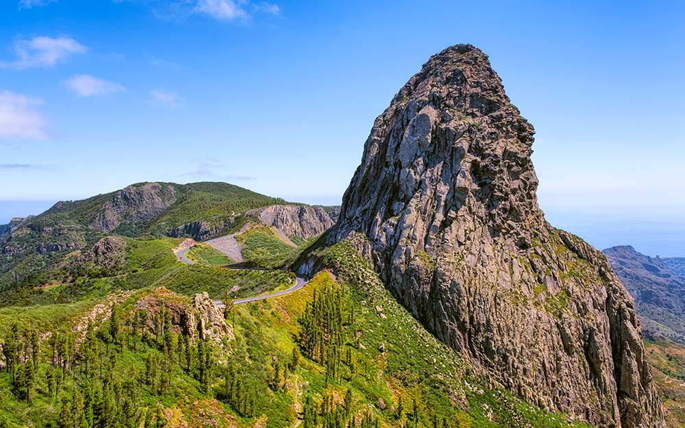
This magnificent Tenerife hiking trail allows you to discover the Anaga massif and its rugged coastline. It is a rural area of the island and not very touristy.
Not many people know about this corner where the turquoise sea merges with dense forests and magical beaches. It is a remote area full of surprises, from mountains to wild beaches and millenary ravines.
Along the first part of the trail, it is quite easy as the slope of the ravine is not very steep. The ravine carries water almost all year round, so you can find small pools along the way and the vegetation is abundant. This part of the path is well signposted and a large part of it is a gentle descent.
After 3 kilometers, just over an hour’s walk, you reach Tamadite beach, one of the most beautiful beaches in Tenerife. Its black sand is a reminder that we are on an island of volcanic origin.
When the tide is full the beach is mainly pebbles and, like most beaches in the north, bathing is dangerous due to the strong and rough waves.
The route continues along a path to the right, where a signpost indicates the way to Taganana. This is one of the toughest parts of the route, as it is here that a fairly steep ascent begins.
However, when you reach the top you can enjoy spectacular views of the rocky coast of Anaga. This part of the trail is beautiful and reveals a wild and unspoiled coastline, where cliffs and small beaches adorn the landscape.
The hiking route ends in the village of Taganana, the most important village in the Anaga Rural Park. It is a village known for being a good example of traditional Canarian architecture where the white houses stand out amidst the green forest of the mountains.
This is a good place to stop for lunch as there are plenty of restaurants. The best option is to go to a guachinche. This is a typical restaurant of the island where locals go to enjoy traditional Canarian dishes.
THE WATER TRAIL IN RAMBLA DE CASTRO
This Tenerife hiking trail, known as the Water Trail, is linear and takes approximately 2 hours. It is only 4 kilometers long, making it one of the easiest routes on the island.
The trail joins the San Pedro viewpoint with Los Roques beach and can be done in either direction.It is located on the north coast of Tenerife and runs through the Rambla de Castro Protected Landscape.
This is one of the most beautiful corners of the island where you cross a ravine, wild beaches and an Eden of palm trees. What is most striking about this area is its abundant and varied vegetation, full of exotic plants.
The starting point is the San Pedro viewpoint. This spot is 200 meters above sea level and offers spectacular views of the coast of Los Realejos and its countless palm trees and banana plantations. Here you will also find a restaurant where you can stop for lunch or a drink before starting the route.
The next point of interest on the route is Castro Beach. This secret place transports you to paradise and is reminiscent of Hawaii.
The most special thing about the beach is that it has a waterfall that falls right onto the sand.
After Castro Beach, you cross a wooden bridge. From the bridge, you can see the old water elevator of La Gordejuela, where the first steam engine on the island was located.
This building is a milestone in Tenerife’s industrial history, although it is currently in a deteriorated state. Even so, it adds a special charm to the landscape of this area.
The route ends at Los Roques beach, which is of volcanic origin. When the tide is low, you can enjoy the beach after the effort. However, when the tide is high you must be content to watch the waves crashing against the rocks.
From here you can return to the starting point of the route by walking along the same path. Alternately, if you have no more strength left to continue walking there is a bus that will take you back to the San Pedro viewpoint.
PUNTA DE HIDALGO TO CHINAMADA
This is another of the Tenerife hiking trails through the Anaga Rural Park. It is a little hidden in the northwest corner of the island, but it is worthwhile visiting.
The starting point is at Punta del Hidalgo and then you head into the Anaga Mountains all the way to Chinamada.
It is a linear trail and quite demanding as it is a steep and steady climb through the mountains. The total climb is up to an altitude of 600 meters in just 6 kilometers.
The round trip takes about 5 hours. But despite the difficulty, the trail reveals a wild and rugged Anaga, a spectacular natural paradise. Along the way, the imposing Roque de Dos Hermanos stands out.
After the great effort of crossing the remote mountains of Anaga, you reach Chinamada. This is a village famous for being an example of the troglodyte habitat that still remains in Anaga. More than a dozen cave houses typical of the area are still preserved here.
Chinamada is also the perfect place to stop for lunch. There is a restaurant called Restaurante La Cueva built into the mountains where you can eat some of the typical dishes of the island.